Rugged Tales

Wherever my feet may take me…


3 Comments

Jurassic Park

Today I was transported back 250 million years. Or at least, so claimed the information board at Orcombe, the start of the Jurassic Coast. After catching the ferry to Exmouth, we successfully dodged one heavy shower through judicious timing of a cooked breakfast, and another while stocking up on snacks. Having bought a new gas canister and posted my one man tent back home (the manufacturers seem confident it can be fixed so I hope that will prove to be the first step on its road to recovery) we were finished in the town and ready for a closer look at England’s first natural World Heritage Site.

It certainly proved educational. I’d barely taken two steps before I learned something new: although it’s known as the Jurassic Coast, the rocks at the Western end actually date from the even older Triassic period. Having studied more chemistry than geology, however, the bit I related to most easily was that the rocks are so red because they have a high iron content. “The cliffs are literally rusting!” the noticeboard excitedly informed me. I also grasped that the Geoneedle, unveiled by HRH The Prince of Wales in 2002 to mark the World Heritage status, was an excellent opportunity for a comedy photo.

20120712-202851.jpg

As we walked over the low cliffs to Sandy Bay we had great views back around Babbacombe Bay, and could see numerous heavy showers dotted over the land and the sea, happy we’d been lucky enough to miss them so far. Sandy Bay itself turned out to have the bizarre juxtaposition of a sizable holiday park and the Ministry of Defense firing range at Straight Point. It was quite surreal picking our way through the sea of static caravans to the accompanying crackle of gunfire. Equally unexpected was Budleigh Salterton. I knew almost nothing about it before I arrived there, other than it’s passing mention in a Monty Python sketch. I now also know that the pebbles there originated over 400 million years ago in the place we now call Brittany. Judging by the appearance of the beach today they are proud to be British now.

20120712-205205.jpg

The easy, level walk round the marshland of the River Otter estuary was a relaxing way to digest my lunch and offered some fabulous views as the sun got the upper hand for a while.

20120712-210026.jpg

And the easy cliff paths over Brandy Head that followed were a world away from the frustrations of yesterday. Although the clouds gathered I escaped with no more than a few drops as I approached the campsite at Ladram Bay. It was a wonderful day, not least because it was so lovely not to be rained on for once, and topped off by a beautiful bright rainbow over the tent as we set up camp. If only all the days could be like this.

20120712-211426.jpg


Leave a comment

Uninspired

The lake that formed under my sleeping mat, and anything else that I put on the floor of the tent last night, was the worst yet. My groundsheet has given up all pretence at waterproof-ness. My poor tent, new this trip, has been rained on to destruction.

20120712-135245.jpg

I packed it away, happy it would be the last time I’d be sleeping in it for a while. My boyfriend Rob was on his way to join me in the evening, and bringing my original two man tent with him – a double cause for celebration! But first there was the small matter of some walking to be done…

Having bailed out at Babbacombe yesterday and caught the bus the last part of the way to Shaldon, the first order of business was to get the bus back again. Embarked on a linear route it felt a bit weird to backtrack and walk down the same hill I’d walked up yesterday. But once I got back to the path it was immediately a different experience. I popped out above Oddicombe Beach, now bathed in sunshine, to enjoy a good view of the dramatic red 5,000 tonne rock fall that closed half the beach in 2010. The cliffs in this area seem particularly prone to collapsing, and the Coast Path is consequently diverted inland numerous times to avoid landslips and unstable edges. Added to the ins and outs and ups and downs already required by the wavy edge of this part of the coast, it made for a particularly frustrating morning.

Adding to the frustration of the roundabout route was the lack of views, which made me feel as if the effort of the walking wasn’t fully rewarded. Above Watcombe the path ran through mature woods: pleasant enough but I really could have been almost anywhere. The most distinctive thing was the sound of someone in the distance performing a bad cover version of Amy Winehouse’s ‘Back to Black’.

20120712-135337.jpg

It was increasingly a soundtrack to match my mood as I struggled along. After an hour and a half I finally reached Maidencombe, a paltry two and a half miles from where I’d started. It felt like I’d done twice that distance and I seriously considered stopping at the pub there for a restorative lunch. But then I saw a sign: ‘Shaldon 3.5km’. Having seen one earlier stating Torquay was 10km in the other direction I was mildly curious as to why someone had suddenly decided to mark distances in kilometres, in defiance of both UK convention and the custom and practice of the preceding 500 miles of the Coast Path. But I also saw an end to my ordeal in…hang on a sec…3.5 divided by 1.6…well, call it just over 2 miles. Even on difficult terrain two miles couldn’t possibly take more than an hour to walk, right? Ignoring all the lessons on time and distance that I’d learned that morning I set off gaily towards Shaldon, self-congratulatory thoughts about my mathematical prowess pushing my earlier frustrations aside.

They didn’t take long to push back in. The ups and downs became steeper and longer until after 50 minutes, at the top of a particularly arduous climb, I saw a signpost. I made my way up to it, confidently expecting it would tell me Shaldon was right round the next corner. When I saw it said ‘Shaldon 1.5 miles’ I could hardly believe it. I didn’t want to believe it. That was, without doubt, the longest, most exhausting half a mile of my life! As the other side of the sign said ‘Maidencombe 1.5 miles’ I had to wonder if the sign on which I based my decision to press on had actually said 3.5 miles, not 3.5 km? I wasn’t going to go back and check, but I’ll swear it didn’t. Perhaps the first sign had just been wrong? Only the other day I’d been laughing with another walker about how unreliable the distances were on the Coast Path signs. Today, the humour in the situation entirely eluded me, and when I caught sight of the next steep descent and ascent ahead I could have sat down where I was and cried. Since that wouldn’t bring me any closer to my lunch, however, I settled on a plan of walking and cursing the sign-maker instead. Muttering under my breath I stomped through that valley, and the next. I didn’t think at this point it was possible for me to be any grumpier, but when I realised that by diligently following the signs I’d slithered miserably over the muddy paths on three sides of a steeply sloping field while a much better path ran straight across the top I cursed not just the Coast Path sign-makers, but the route designer and the person who’d had the idea of creating the whole stupid trail in the first place. On the up side, it’s lucky I was on my own: it’s possible that in the course of my cursing I used some quite rude words. I finally made it to Shaldon having taken three hours to cover what I guess was about 5 miles. Mr Dillon wasn’t kidding when he wrote in his guidebook that “…the Coast Path between Torquay and Shaldon…involves a lot of time and effort.”. I found it an uninspiring section, walked just to say I’d walked it.

Happily, once in Shaldon, things started to look up. When I arrived last night, wet and tired, I hadn’t been in the mood to explore but Shaldon turned out to be a lovely village. I pottered around a little then bought some lunch and returned to the beach to eat it. The ferry I needed was just departing but I decided that, since it continually shuttles back and forth, I’d take advantage of the benches in the ferry shelter to eat my food and catch the next one. It was a lucky call. No sooner had the ferry – the oldest working ferry boat in England – pushed off than a heavy shower poured down on the passengers huddled unprotected in the open craft. My laziness in not running for it had been handsomely rewarded!

20120712-155017.jpg

Once across the River Teign the good mood brought on by the twin pleasures of lunch and a lucky escape was further boosted by a delicious ice cream as I strolled along the promenade at Teignmouth. I was happy to tolerate the First Great Western trains thundering along beside me in return for the flat, easy path Brunel’s South Devon Railway sea wall created. The herring gulls had found their own use for the structure: I passed Dawlish to the clatter of mussel shells falling onto the concrete from a height, and the subsequent squabbling of the birds over the results of their handiwork. By the time I arrived at Dawlish Warren to be reunited with my boyfriend and my other tent, all was right with the world again. And with the start of the Jurassic Coast just after Exmouth tomorrow I went to sleep feeling optimistic that what’s ahead would make up for what was immediately behind.


Leave a comment

Wildlife encounters

At 8am on 6th July I set out to walk the 19 or so miles to Brixham. This evening, I finally arrived. The weather was so bad yesterday I decided to take another day off, the only snag being that the hotel where I’d taken shelter was fully booked. As check-out time approached all hope of a late cancellation seemed gone. Not particularly keen to return to my tent on such a wet, miserable day I prepared to try and find somewhere else, but with minutes to spare I was granted a reprieve. The gentleman who had booked my exact room rang and cancelled. I felt like Christmas had come early! I stopped packing, made myself a cup of tea, and settled down with a good book.

Much as I like camping, I was increasingly seduced by the benefits of an indoor life. Dry and warm, surrounded by a cloud of fast wifi with a plug to charge my phone up whenever I liked and just a few feet of carpet to traverse if I needed the toilet, my little hotel room had many benefits compared to the wet, muddy fields that have become my typical residence. It cost me a small struggle to give up all these comforts, even when I got up this morning to a glorious sunny day. I hung out at the hotel until the last possible moment to get the maximum enjoyment from all it’s delights, before shouldering my pack and heading back onto the Coast Path.

Stepping outside the door I was amazed to find the hotel had a sea view! Thinking about it, I suppose that shouldn’t have come as such a surprise: Stoke Fleming is right on the Coast Path and the hotel not very far inland. But there’d been absolutely no hint of the view for the 48 hours I’d been there. The outdoor pool, which hadn’t interested me before, now looked enticing and as I pictured a relaxing day reclining on one of it’s sun loungers I felt my resolve weakening. But I stayed strong and walked resolutely out of the grounds.

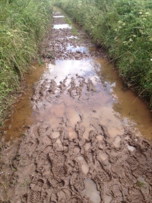
The route initially followed the road, but as I made for the turn off to the cliff path at Little Dartmouth carpark a couple coming up behind me cautioned against it. They’d been warned in turn by a group in wellies who had just emerged from that stretch of path with tales of calf-high mud. In walking boots, they said, it would be impassable. Thanking them for the tip I set off towards Dartmouth Castle by an alternative route along the ridge line, badged as the ‘Diamond Jubilee Way’. And if that was the ‘good’ path I’m glad I didn’t try the other one! It was extremely muddy, and though it would have been an easy stroll in good conditions the thick slippery mud and deep path-wide puddles made for slow going this morning.

20120709-082043.jpg

It got even worse when the path ran down to a dip in a cow field. I struggled to keep my feet in the quagmire born of numerous hooves trampling in the pooled rainwater, and began to wonder whether walking to Brixham would be possible in these conditions. What if it was all like this? I couldn’t be more than a mile or so away from the hotel. Maybe I should go back there and wait another day or two for the paths to dry out and… I ruthlessly stopped that line of thinking and, regaining a drier bit of path, set off again for Dartmouth.

Having already been there on the bus I had the unusual sensation of walking into a town and knowing where things were. Quickly picking up some lunch and a couple of other supplies I ate my food on a sunny bench on the Esplanade before catching the ferry across to Kingswear. Now the fun started: a 10 mile stretch to Brixham reputed to be pretty tough. But as with the last ‘tough’ stretch I really enjoyed it. The unspoiled scenery and peace of a relatively inaccessible section more than compensated for the extra effort of the ascents and descents.

20120709-084109.jpg

But the highlight of the day was the wildlife. I saw a big grey seal swimming along near Froward Point. There are only about 30 or so off the South Devon coast even around September, the peak seal time, so I felt fortunate to see one. I was also lucky to see Peregrine falcons on the cliffs at Pudcombe Cove (through the telescope of a lovely man who was watching then there) and, later, circling high on the thermals over the cliffs.

And despite my fears, the paths weren’t too bad on the whole. I guess steep sided valleys drain quite well! There were a few muddy patches, and a few places where steams had burst their banks and were running down the adjacent paths or spreading out to form mini-marshes to paddle through. But the only really sticky moment came at Mansands Beach. The National Trust helpfully suggested a two and a half mile detour to avoid possible deep water crossing the steam on the beach as a result of the recent heavy rain. For a horrible moment I thought it was going to be the Erme all over again! Fortunately, this steam came up to your thighs only if you were a young child, and had chosen an injudicious place to cross! Too lazy to take my boots off, I managed to jump across one of the narrower points.

20120709-092916.jpg

From there it was a an easy walk round Berry Head and into Brixham – at last! And just time for one last encounter with the wildlife before bed: picking off two small ticks that had attached themselves to my leg. Eeughhh!


1 Comment

Running up that hill

Today’s stage was an enormous 19.5 miles, not counting the mile and a half to get back to Salcombe from the campsite and another mile or so to get to the campsite at the other end. I wasn’t sure I’d be able to walk quite so far in a day with all my gear, but I figured I’d give it a try and see how it went.

After an uninspiring walk along the A381 to get to the campsite last night I went back by the route recommended by the farmer’s wife instead. A vast improvement, it wound down the side of the hill and along the edge of the estuary: a relaxing and picturesque start to the day. The ferry ride across to East Portlemouth and the subsequent woodland path round Mill Bay carried on in the same vein, but if I was going to get to Stoke Fleming by evening I needed to keep up the pace. There was so much to see, however, I didn’t feel like hurrying past it all.

The rugged path to Prawle Point was similar to the walk I’d enjoyed so much yesterday, and the scenery was just as fabulous.

20120705-215914.jpg

Then I had lunch at Kate Bush’s house. Or at least, on a cliff-side bench with a view of her house. Although it may not have been Kate Bush’s house at all; I only have the opinion of a local guy I’d bumped into earlier on the path on that point. Still though, it was a good spot for lunch with a good view of Start Point as well as possibly-Kate-Bush’s-house.

Start Point, when I reached it, was one of my highlights of the whole Coast Path so far. The anticipation began with a sign about a mile beforehand asking walkers to “Please exercise extreme care when using this section of the coast path.” What could be ahead??! It turned out to be a relatively narrow unfenced ledge, which wasn’t especially dangerous in the dry, calm conditions today but I can see could be risky in bad weather. The headland itself – one of the longest in Britain – made a dramatic sight as I approached it: a spiny ridge dropping down into the sea.

20120705-221759.jpg

And as the path went up and over the ridge-line, suddenly revealing the wide expanse of Start Bay, the glorious unexpected vista took my breath away. Start Bay is an ever-changing coastline, it’s particular geology channeling the energy of winter storms in such a way as to continually change the contours of the shore. Human activities interact with these natural processes, of course, sometimes with catastrophic consequences. I walked past the ruined village of Hallsands, almost entirely destroyed by a storm in 1917 after decades of shingle dredging eroded the beach that protected it. The last remnants of the village clinging to the base of the cliff are a poignant reminder of the tragedy, for which the villagers were never properly compensated.

20120705-223056.jpg

Sobered, and a bit tired, I arrived at the village of Torcross where a board on the sea-front advertised ‘The Best Cream Teas’. Clearly, that was a challenge I could not ignore! And the Sea Breeze cafe’s claim was no idle boast. de Wynns in Falmouth have met their match, though I’d be hard pressed to say which was the winner. I will have to declare it a tie until I can sample them both again…

Reenergised by such top notch refreshments it was an easy, relaxing walk to the other end of Slapton Ley, the largest natural lake in the West Country. With just five miles left to Stoke Fleming I started to think I’d actually be able to do it, and phoned ahead to book the campsite. Lucky I did: their field was flooded by all the recent rain and they weren’t taking anyone. No problem – the map showed another campsite at Strete a couple of miles closer. I googled for their phone number, just to check, and in the process discovered it was in fact naturist campsite. I entertained the idea for a moment: as Arnold Bax is reputed to have said, you should try everything once in life except incest and morris dancing. But I decided it was too cold. So I found myself staying in Slapton – my emergency fall back location if I didn’t think I’d go the distance – after all. But with a lovely pitch with a sea view, my laundry done and a belly full of homemade chicken and ham pie from The Queen’s Arms I can think of many worse places to be stranded for the night.


Leave a comment

Transformation

Thick fog, more rain. They’d forecast a drier day today but there was no sign of it when I got up. Since the ferry across the River Avon from Cockleridge to Bantham didn’t start running until 10 there was time for one last cup of tea with Rachel before slithering down a very muddy, steep field to catch it. Or, more precisely, to yell for it. This ferry doesn’t have one of those wooden sign boards that you open up to show you want to cross. Instead, you apparently yell and wave and generally make a spectacle of yourself until the ferryman notices you. Lingering over my tea (and who wouldn’t prolong a cosy tea and a lovely chat in the face of a wet, muddy walk ahead?) I got to Cockeridge Ham a bit later than I planned, and delayed myself further by stopping to chat to another walker (a young guy rough camping by the estuary). By the time I got to the ferry point two other walkers had done the hard part for me. Glenda and Val have walked most of the Coast Path in stages over a number of years, while saving the killer North Devon section for last. I met them yesterday when they arrived in the cafe – drenched – after bravely walking as planned.

And it looked as though another drenching might be on the cards. We huddled miserably in the little boat as the rain grew heavier, and even the ferryman looked fed up – persuaded by the ‘brightening up’ story he didn’t even have a coat on!

20120705-065911.jpg

Once in Bantham I thought I’d go for a coffee with Val and Glenda rather than stay out in the rain and we headed into the village. But by the time we’d established that the pub wasn’t open yet and the shop had no cakes the rain had stopped and I decided to press on after all, having roughly twice as far to go as them.

As I negotiated the muddy paths round the edge of Thurlestone golf course I caught up to the young chap I’d met before and we walked along together for a bit. It turned out his name was also Chris, and he was also walking the Coast Path in stages over several years. But where Glenda and Val favoured a relaxed pace with plenty of coffee breaks and delicious lunches in good restaurants (I think they may be onto something…), Chris was aiming to walk from Plymouth to Poole (some 220 miles) in 10 days. After being so comprehensively rained on since he started this leg though, he was wondering if he shouldn’t have come in September instead.

But as we approached Hope Cove it did seem that there was cause for optimism. The brightness in the sky was starting to approach squinting levels and we agreed our waterproofs were becoming uncomfortably hot. We parted company in the village – Chris for a cigarette and me to forage for lunch – and when we bumped into each other later we were almost unrecognisable. T-shirts and sunglasses had replaced top-to-toe waterproofs and enthusiastic gesturing at the beauty of the landscape had been substituted for grousing about the unseasonable weather. We were not the only thing transformed. As we rounded Bolt Tail some spectacular cliff scenery opened up, set off to perfection by the blue sky above and the deeper blue sea below. In the sun, it was like another planet.

20120705-075725.jpg

At Soar Mill Cove I said goodbye to Chris and strolled on happily along the cliff tops. The stretch from Bolt Tail to Salcombe was one of the most fun walks I’ve done on this trip so far, and I particularly enjoyed working my way round the rocky ledge at the base of Sharp Tor.

20120705-080655.jpg

The recent bad weather has certainly given me a new appreciation of the good days, and not even a direct hit from a seagull could dent my mood as I pottered round Salcombe with an ice-cream shopping for dinner. Sitting outside my tent in the evening sun to eat it, looking out on a fabulous view of the Kingsbridge Estuary, I could hardly remember that the day had started out in fog and rain. With a long day ahead tomorrow I really hope the weather holds.


Leave a comment

Time and tide

Having to adjust your plans to suit the tides is, I’m sure, an integral part of the Coast Path experience. I was happy, therefore, not to have missed out. Honest.

Heading onwards from Wembury it’s an easy 30 minute walk to catch a ferry across the River Yealm, which operates from 10am-4pm. From there it’s a further three to four hours’ walk to the mouth of the River Erme, which can only be forded at low tide. I checked my tide tables and discovered low tide was at 10:21am, so that should be no probl…wait a second…oh. I considered:
1. Walking round the Erme – an eight mile detour, which would necessitate a night’s rough camping as it would make the day infeasibly long and there are no campsites on the way
2. Getting a taxi round the Erme – about £25 (ouch!)
3. Waiting a few days until the low tide time aligned with the ferry better – but I didn’t want to lose that much time.

With hindsight, I was so focused on the Erme I missed the obvious solution: to make an early start and either walk or taxi round the much shorter (maybe two miles?) road route around the Yealm instead. But by the time that thought had struck me the tide had long since turned, and to be honest after two tough days the prospect of being packed and ready to go by 6am was not at all appealing. Deciding I’d earned a more relaxing day, I left the alarm off, strolled mid-morning to the Warren Point ferry slip, and cooked up a better plan with the help of Billy the boatman as he took me across the Yealm.

20120701-194302.jpg

Billy very kindly checked the tide times and the shipping forecast for me, suggested a good walking circuit for the afternoon and pointed me towards the campsite. And he drove up the hill after me when he realized he’d given me the wrong time for low water, which was really above and beyond the call of duty. And as a result of all that planning and advice, I’m camping tonight in Newton Ferrers, less than two miles as the crow flies from where I stayed last night!

But I’ve not been idle. Having pitched the tent I did an eight or nine mile loop around the cliffs (including five miles of the Coast Path) to save time tomorrow. I’m glad I did. Despite a showery start when it looked like the weather was only going to deteriorate, by the time I’d pitched the tent, eaten lunch and walked back out to the cliff top at Beacon Hill it had turned into a lovely sunny afternoon – much too good to waste.

20120701-194729.jpg

The route back round to Noss Mayo was reasonably level and easy, and despite the soreness in my legs from the last couple of days I made good time: it’s wonderfully easy without the pack! As a result, there was plenty of time for a delicious cream tea in the riverside tea garden in Noss Mayo. It was so tasty I gobbled it all up before I remembered to take a photo. Luckily the view lasted longer!

20120701-195153.jpg

The tea garden’s owners, Cathy and her husband Andy, were as friendly and helpful as Billy had been, warning me of a campsite to avoid in Bigbury-on-Sea and suggesting another much nicer one. And when I stopped off at the convenience store on the way back to the campsite I found the staff, and even the other customers, equally friendly and chatty. The pub in Wembury last night was the same. Stuffed full of local River Yealm mussels, sun-kissed and bowled over by how friendly and welcoming everyone has been, I might never want to leave this beautiful corner of Devon.


2 Comments

I came, I saw, I ran away as fast as I could

My private campsite last night was so lovely and peaceful, and I was so tired after a tough day, that I didn’t wake up until after seven. So much for an early start! And it promised to be another long day. My guidebook suggested spending a night in Plymouth, but since Plymouth isn’t big for camping I decided to try and compress three of the book’s stages into two so I could camp either side of it. Today was the second of those days, and an even greater distance than the first one, but at least I was lucky with the weather. It was still very windy but sunny with it, and much clearer than yesterday. When I first arrived back at the cliff top from my campsite in the valley I was amazed by the view back around the bay, and by how close Rame Head had got under cover of yesterday’s mist and low cloud!

But one thing I didn’t see all morning was Plymouth. By virtue of the shape of the coast, and the routing of the path through some dense woodland, it remained hidden until the last minute before being dramatically unveiled close as if at the conclusion of some giant conjuring trick. I boarded the ferry at Cremyll to close the last part of the distance, and so left Cornwall behind after some 280 miles of coastline.

In addition to being momentous, it was an unusually exciting ferry ride. A Spitfire flying low over the city in loop-the-loops and barrel rolls elicited oohs and ahhs from all the passengers. But arriving at Admiral’s Hard I came down to earth with a bang. After weeks of walking alone on remote cliffs, during which I’d come to view places like St Ives (population ca 12,000) and Penzance (population ca 30, 000) as big centres, Plymouth (population ca 260,000) was a shock to the system.

A huge amount has been done to make the route through the city attractive and interesting, and I enjoyed the redeveloped Royal William Yard, and the Sherlock Holmes quotes set into the pavement of Durnford Street (where Arthur Conan Doyle once lived). But the signage – though striking when I found it – was sporadic, and even the guidebook gave faulty instructions at one point. Thank heavens for Google Maps, or I’d probably still be wandering hopelessly around Millbay Docks!

20120701-094219.jpg

As I approached The Hoe the crowds were denser than I expected, even for a sunny summer Saturday. Stopping to read a ‘road closure’ sign I realised I had unwittingly walked into the middle of Armed Forces Day. In hindsight, the Spitfire thing probably should have tipped me off… It looked like a fantastic family day out, and a great way to celebrate the contribution of the many men and women who serve our country. But the noise and the crowds were too great an assault for my senses. When Johnny Vaughan took the microphone and informed the crowd that there would be an opportunity later to meet Justin Bieber, the ear-piercing shriek from a young woman standing next to me (who, frankly, looked a bit old for him) was the final straw. I abandoned my attempt to admire Smeaton’s Tower, and fought my way back to the road.

20120701-094437.jpg

I stood in front of the Royal Citadel to get my bearings until I realised that the guns that we’re about to fire a salute were directly over my head. Hastily retreating towards the marina I instead watched a so-many-guns-I-lost-count salute from a ship sailing by. Unfortunately, having an almost no knowledge of the Navy other than that it exists, I can’t tell you what ship it was, or even what type, only that it was very large and grey. If any of my better-informed friends knows then I would be grateful for the instruction! I feel somewhat embarrassed by my ignorance, especially having grown up within 20 miles of Portsmouth, and am resolved to educate myself a little when I get back.

But for today, the boat I was most interested in knowing better was the Mount Batten ferry. A lengthy battle with the crowds in the Barbican to buy so much as an ice-cream had crushed the last of my interest in seeing more of Plymouth today, and my only thought was how to effect the speediest escape. Although I missed out 5 miles of the Plymouth Waterfront Walkway by catching the ferry, I’ve added on that many extra miles in the last few day alone going to and from campsites, and there seems to be no logic I can follow about when a ferry is an established part of the route and when you’re supposed to walk round. I decided the ‘cheat’ was not such a heinous one, under the circumstances.

Even with the shortcut I’ve covered 40 miles in the last two days, and am quite tired as a result. Luckily, the end of the day proved a perfect restorative. At Mount Batten the crowds immediately fell away and from there to Wembury was a peaceful, relaxing walk over generally easy terrain, with some great views back towards the city from a suitably safe distance.

20120701-094548.jpg

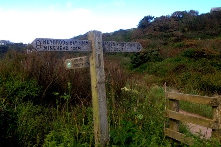
A sign at Wembury Beach gave the distances to Minehead and Poole. I can’t quite believe that there are ‘only’ 206 miles left to go! But I’m relieved none of them are likely to be as densely populated as today’s.

20120701-094733.jpg


Leave a comment

Paradise regained

‘Here we go again!’ I thought, emerging from my tent to find everything wreathed in fog. Happily, I got a reprieve from having to go out in it by the discovery that there were no laundry facilities at the next two campsites. With an urgent need for clean pants and socks, it was clearly imperative that I do my washing before I left – and drink tea and eat biscuits while I waited! But eventually there were no more chores to do and nothing for it but to start walking.

It looked like it might be brightening up, and I’d not been going 10 minutes before I had to stop and rummage in my pack for my shades and my sunscreen. It felt like an age since I last needed them! And as I walked down the lane away from the campsite a wonderful view opened up across the fields and down to the sea: quintessential English countryside, complete with the tiny Tregaminion church. Who knew that was there?! I started making my way round Gribbin Head, and was quite startled by the views back across the bay to St Austell. There were the massive spoil heaps from the china clay works, the factories and the docks. If I hadn’t have read about them in the guidebook I’d never have suspected their existence yesterday. As it was, they were much more extensive than I’d imagined.

It turned into a glorious sunny day, and though the paths were still muddy and overgrown the fresh breeze, and the late start, had dried out the grass. That alone made it a huge improvement on yesterday and in some places, like the area around the enormous Gribbin Head day tower, the going was refreshingly easy.

20120629-144712.jpg

I didn’t expect it would remain so, however; the seven mile section from Polruan to Polperro was reputed to be particularly tough. I fortified myself with a pasty in Fowey, admiring the unusual knitted decorations all around the harbour railings as I ate, then caught the ferry across to Polruan to run the gauntlet…

20120629-144757.jpg

It was fantastic fun! It’s true there were more, and steeper, ascents and descents than on previous stages, but it was still nowhere near as tough as the roller-coaster cliffs on the North coast. The paths were mostly clearer and drier, and the terrain much more open so the spectacular scenery was in view most of the time.

20120629-144844.jpg

It was a world away from the thankless trudges through a sodden overgrown strip between a high hedge on the seaward side and a farmer’s field on the other that have characterised the last few days. As I strode along the remote paths, drinking in the views I remembered why I wanted to walk the Coast Path – and fervently hoped the worst of those ‘jungle paths’ are behind me now.


Leave a comment

Messing about in boats

I thought I might be needing a lifeboat last night, it rained so hard! But by the morning the wind died down, the rain slowed to a light patter, then stopped, and I ventured outside the tent. I’d pitched in the most sheltered location I could as protection from the strong winds, but that was also the lowest – and now wettest – point in the field. Fortunately, my tiny tent fit on top of a slight mound and thus stayed dry underneath where pools of water had formed on the grass all around – it put me in mind of Ely cathedral in the middle of the flooded Fens! Although it was a soggy experience getting in and out, not everyone was displeased with the state of affairs; as I ate my breakfast a blackbird made use of the puddle nearest my door as a bird bath.

20120625-091841.jpg

I waited until the last few showers had died out then packed up my gear and set off for Falmouth. Although I’d already visited the town yesterday I’d gone by the direct, inland route – and by motor vehicle. The Coast Path, which goes all the way round Pendennis Point, was a lot further but full of interest. As the last of the clouds burned off to reveal a fine summer day, I passed several attractive beaches and got fine views of Pendennis Castle before skirting Falmouth Docks. I hadn’t appreciated before the scale of operations there – and was astounded at the size of some of the container ships!

20120625-091927.jpg

Passing the faded grandeur of streets of Victoria villas I arrived outside the museum. In a brand new development in sharp contrast to the industrial docks and the adjacent residential district, the museum sat on one side of a wide plaza enclosed by smart eateries. I didn’t have time to go inside, but it seemed like as good a place as any for lunch.

As I sat on the plaza steps eating my Rick Stein takeaway fish and chips (very tasty) Jillian’s husband Jim walked up. Jillian had stopped in Helford yesterday as the low tide had stopped the ferry, and he was waiting to meet her in Falmouth later that afternoon. It was lucky I bumped into him because it turned out that, just feet from where we sat, a remarkable concentration of J class yachts were moored in preparation for a regatta next week. I’d passed by the marina, and noted the large number of boats but – not being a sailor – had totally failed to appreciate that some were pretty special. Once my attention was drawn to them, however, I could see why any discerning Prince or Sheik might want one! (They’re the ones on the right for any other yacht dummies like me.)

20120625-092010.jpg

From there it was just a short stroll up to the quay to catch the less costly and less beautiful – but more practical – St Mawes ferry. It took about 30 minutes to cross and it was perfect weather to be on a boat. I clearly wasn’t the only one who thought so: everywhere I looked were yachts racing, ferries crossing and a myriad of other craft on unknown missions. The harbour at St Mawes was lovely too but I didn’t have much time to appreciate it before hopping onto the next ferry to Place.

20120625-092124.jpg

After all that boating it was quite a shock to have to walk again. But the stroll round St Anthony Head, through the old fortifications that (together with those I saw on Pendennis Point and by St Mawes Castle) helped defend this huge natural harbour, and up to Portscatho was a pleasant one and not too demanding. And I think I saw one of those gorgeous J class yachts sailing along off the shore beside me as I went.


2 Comments

Maslow’s hierarchy

A mile into today’s walk I reached Porthallow – 315 miles from Minehead and the half way point of the Coast Path. Described by the Falmouth Packet, when a new Coast Path monument was unveiled in 2009, as an ‘enormous psychological moment’ for those walking the whole path, I’d been eagerly anticipating this important milestone. When the moment came, however, I forgot all about it.

Looking back I attribute this to Maslow’s hierarchy. I had spent the night at the Porthkerris dive centre, which has a pleasant, quiet camping field at the top of a cliff….and showers and toilets at the bottom. Faced with a 15 minute round trip down and then back up a very steep road to use the facilities, and with a long day ahead, I decided it would be more efficient to just start walking along the path. In 20 minutes or so I would reach Porthallow and could use the public conveniences there instead. By the time I arrived in the village my desire to find those facilities, and relief in succeeding, totally eclipsed any thought of the half-way point!

With that over, my focus moved up the hierarchy a little, but only to the practicalities of the day’s walk. From Nare Point I had a good view of the two inlets I needed to cross by ferry – Gillan Harbour (on the left of the photo) and Helford River (on the right) – to get to Falmouth.

20120624-092916.jpg

The Helford ferry details I already had from their website but the Gillan Harbour service had only a phone number. Deciding 8:30am wasn’t too early to call, I enjoyed a second wave of relief before I left Porthallow when the gentleman I spoke to confirmed the Gillan ferry would be running from 9:00. I set off happily and it was only after another hour of tricky, muddy, overgrown paths when I was safely on his little boat that I remembered about the halfway marker. By that point I wasn’t going back for it!

After another hour or so if walking I arrived at Helford, opened the sign to show it’s orange innards to the world, and settled back to wait for the ferry to arrive.

20120624-094353.jpg

Twenty minutes later it did, requiring a conscious effort on my part to relax on the quayside when both my London conditioning and my desire to get to Falmouth before the shops shut made me chafe at the delay. Even after all these weeks I still find myself surprised – though ultimately pleased – by the slower pace of life.

But I wasn’t pleased today! With the next major shopping opportunity not until St Austell (four or five days away) and my need for supplies acute, I pressed ahead and made excellent time, hitting Swanpool Beach on the outskirts of Falmouth just after 2pm. Even with some frustrating backtracking after discovering the nearest campsite to the path had been sold for a housing development, I had time left over after my errands were run. What better way to spend it than sampling the cream tea in de Wynn’s famous tea shop?

20120624-095716.jpg

Not a lot I would hazard: my Falmouth cream tea has leapt in at the top of the charts. Light tasty scones with a mushy jam that was mostly strawberries and tea served in an old-fashioned rose-patterned tea service, it was as charmingly presented as it was delicious. The traditional tea room ambience came complete with a soundtrack of crooners, and its location provided a fabulous view over the harbour. Add in a team effort from two waitresses, the lady – a regular – at the table behind, and a couple at the table next to me with a copy of Falmouth’s tourist transport guide, all helping me work out where the number 500 bus back to the campsite would leave from, and it was undoubtedly my best all-round cream tea experience so far. As another storm moves in and I’m huddled in my tent with my little burner struggling to heat my dinner in a strong wind and heavy rain, it’s good to have the memory of it to help cheer me up!