Rugged Tales

Wherever my feet may take me…


Leave a comment

A perfect ending

As my journey drew to a close I met another hiker just setting out to walk the entire Coast Path in the opposite direction.  He did it last year, he told me, and enjoyed it so much he was back to do it again in the opposite direction. I couldn’t help expressing my surprise, and may even have included the phrase ‘glutton for punishment’, but he was confident I’d feel the same way.  “Not right away, of course, but give it a month or two. You’ll see.” he added, with a sage nod. Standing there on my sore feet, legs stiff and aching from yesterday’s exertions – not to mention those of the preceding 620 miles – I was more interested in finishing than in starting again, and the end was getting closer by the minute.

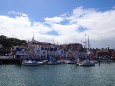
A few easy miles and a low hill brought us to Swanage beach, crowded with families excited that summer had finally started

.Image

We joined the happy throng with my sister, brother in law and their two children. It was a lovely reintroduction to home life after so long on the road: eating a picnic lunch, chatting with my family, jumping over the waves with my niece and watching my baby nephew discover that sand is fun in your fingers but not in your mouth. I could have sat there all afternoon but there was the small matter of the last six miles to attend to.  Brushing the sand off my feet, I put my boots back on for the final time and headed back to the Path.

It was a perfect summer day, and as I climbed up to the top of Ballard Down I was grateful for the breeze to offset the heat of the sun and the walk up. Two paragliders launched as I approached the top, and wheeling low above my head in the thermals of the cliff we waved to each other as they glided by.  A little further and I rounded The Foreland, my final headland, Old Harry rocks shining bright white in the late afternoon sun.

Image

But my gaze was drawn the other way: to my first glimpse of South Haven Point, the end of the Path. I walked on to Studland and catching sight of a board outside the Manor House Hotel advertising Dorset cream teas in their stunning gardens overlooking Studland Bay it was as if fate had brought us together. I was in! But a quick call to check they were still serving revealed that, while they were open, they had sold out of scones and clotted cream after an unusually busy day. I was crushed! I walked on around Studland Bay, contemplating an ice-cream instead to console me, and there were plenty of kiosks: but my heart wasn’t in it.

When the National Trust cafe at Knoll Beach hove into view a flicker of hope was rekindled. I approached the door, hardly daring to look inside for fear of another blow: but yes!  There were scones!  I scanned the menu board, and there it was: “Dorset cream tea – Large (2 scones) £4.95”. Relief flooded through me; to have finished the walk without a final cream tea would have been to have left things somehow incomplete. The cream tea itself was not the best I’ve ever eaten: after a long, hot day the scones had become a little dry, and the queue to get them was tedious. But sitting in the sun on the back of the beach, just two miles from the end of the Coast Path, it was still an entrant in the cream tea challenge that will always have a special place in my heart.

Back on the trail, licking the jam off my fingers, I found the sands of Studland Bay were an altogether calmer affair than the happy chaos of Swanage Beach. Boules seemed to be the amusement of choice – I counted three separate games within 50 yards of leaving the cafe.  As I moved further away from the car park the crowds thinned still more until it was just me with the oystercatchers and stints probing the sand at the waves’ edge.  Oh, and some naked people.

Image

Studland Beach, it turns out, is a popular spot for naturists.  “If you’d been here a minute or two earlier I’d have posed by that sign for you,” called out a man pulling on his shirt a few metres away.  I told him I thought that was above and beyond the call of duty, but it was very kind of him to offer.  We parted on a less bold note – an agreement that it had been a really beautiful day – and in fact I couldn’t think of a better end to the walk.  As the tide went out a wide, firm, flat expanse of sand was left beneath the clear blue sky. It couldn’t have been better for walking. Rounding the final corner I felt I could go on for ever, or at least, until I got hungry again. I was almost sorry to reach the monument marking the end.  I couldn’t quite believe that, just like that, it was all over. The struggles, the frustrations, the appalling weather and the terrible conditions of the last weeks melted away under the hot sun of a perfect English summer day.  I looked at the sign pointing back towards Minehead.  Maybe….

Image


Leave a comment

Up, up and away

Having walked a good bit of today’s stage before and loved it (it was one of things that made me decide to walk the rest of the Coast Path) I was really looking forward to the rematch: but also slightly nervous. I remembered the 10 mile walk from Lulworth Cove to Houns-tout Cliff being pretty tough and today, due to an absence of intermediate campsites, we were aiming to do nearly twice that, carrying all our gear. From campsite to campsite would be about 19 miles, with over 1,300 metres of ascent: equivalent to climbing Ben Nevis (the highest mountain in the British Isles) but about twice as far.

This was a walk that took no prisoners. From the first descent to Stair Hole from our campsite above Durdle Door, the roller-coaster chalk cliff line got progressively higher and steeper with each hill we climbed. But the views were worth the effort. The path up out of Arish Mell was the steepest of them all, but gave the most spectacular view back over the cliffs above Mupe Bay.

20120722-100112.jpg

The white chalk cliffs soon gave way to orangey-brown mud and sandstone, and then – thankfully! – to lower grey cliffs of Kimmeridge Clay, thin limestone ‘ledges’ radiating out from them into the sea. We passed the UK’s oldest continually producing oil well at Kimmeridge Bay and stopped for lunch and a welcome sit-down beside Clavell Tower, a 19th century folly and observatory about to fall into the sea until the Landmark Trust moved it back 25 metres to safety.

20120722-101255.jpg

The last challenge of the day was Houns-tout Cliff: not as steep as the hills this morning, but still tough for my tired legs. Fortunately I had the gorgeous view of Chapman’s Pool to take my mind off the protesting screams of my quads as I tottered down the other side.

20120722-102228.jpg

And with that, the worst was over: for the day, but also for my Coast Path walk. From our camp for the night above Dancing Ledge to the end of the Coast Path at South Haven Point is just more 12 miles of easy level walking. I can’t quite believe that I’ve come so far, or that the end is so close. Poole is, quite literally, just around the corner.

With its incredible variety of scenery and interest, its challenges and rewards, and not least the perfect summer weather, today has been one of my absolute favourite days. The route was as tough as I remembered it, but despite having my gear this time I found it easier. I guess 600 miles of walking has made me fitter! After all the wet, exhausting, demoralising moments when I wished it could all be over, after such a great day I don’t wan’t it to end. Ironically.


Leave a comment

Halt!

My walk came to an abrupt halt today at the command of the Army. A mile or two on from our campsite the Coast Path enters the Lulworth Ranges. The home of the Royal Armoured Corps Gunnery School, they apparently had their own use for the firing ranges today.

20120720-214112.jpg

According to my guidebook “The ranges cover some of the best coast in Dorset and it is a great shame to miss it.” We therefore resigned ourselves to yet another day off but while we settled back to relax and enjoy it the Army were clearly hard at work. We ate breakfast to the sound of distant gunfire, the tanks making an altogether more intimidating noise than the rifles we’d heard from the Royal Marines Ranges at Straight Point.

It made a pleasant change to have a day off where it wasn’t pouring with rain. Unfortunately, we weren’t the only ones who thought so. The upside of the terrible weather has been the deserted campsites. But the combination of an improved forecast and the start of the school holidays bought other tourists out in force. By the end of the afternoon our quiet pitch under the trees had become a melée of tents, cars, dogs, barbecues and children.

20120720-220639.jpg

We escaped the chaos and walked down into Lulworth Cove for dinner. Full of good steak and mellowed by a glass of red wine the sunset over Durdle Door was the perfect end to the evening.

20120720-221400.jpg

If only little Jacob next door could be persuaded to stop larking about – and periodically yelling – I could get some sleep…


Leave a comment

Golden arches

Another day, another diversion, this time to avoid the Olympic site in Weymouth. I was initially annoyed to be deprived of the walk around Nothe Fort, but the diversion took us past the Crow’s Nest Bistro in Hope Square where we enjoyed a fabulous cooked breakfast. As I walked on up to harbour, belching discretely, I reflected that in hindsight this was one detour I was pleased to have made.

The harbour was a lovely sight, bathed in sunshine, fringed with historic buildings and filled with boats of all types. I hadn’t realised Weymouth was so attractive.

20120720-152402.jpg

The Esplanade, with its B&Bs, deck-chairs and ice-cream kiosks stretching almost to the horizon, conformed more closely to my expectations but I was relieved to find that it retained more charm than Torquay. And once past Bowleaze Cove and up onto the cliffs the scenery got better and better as the low grey and brown cliffs gave way to the characteristic rolling chalk Purbeck coastline. I was thoroughly enjoying myself, despite the effort involved in getting up and down the increasingly steep slopes.

20120720-145931.jpg

And we saved the best for last. As we walked I excitedly told Rob all about Durdle Door, the spectacular rock arch I’d visited before on a family holiday to this area. “But that was 20 years ago, right?” he asked. “How’d you know it’s still there?”. “Of course it’s still there!” I replied, indignant.

Wasn’t it…?

Although I guess, in time, it is the fate of all rock arches to degenerate into stacks, happily Durdle Door is still standing for the moment, and if anything more impressive than I remembered it.

20120720-151555.jpg

I’ve seen so many rock arches along the Coast Path I’ve lost count but this one knocks them all into a cocked hat. Rob wondered where the other half of the doughnut was. And it’s true all those ascents and descents give you a good appetite!


Leave a comment

Stone cold

Today’s stage was a circuit of the Isle and Royal Manor of Portland, Gateway to the Jurassic Coast. I was puzzled as to how a place can be a ‘gateway’ to somewhere it’s in the middle of, but at least this conundrum gave me something to think about during the tedious three mile trudge along the edge of the A354 that links the island to Weymouth.

When I arrived in Chiswell another, physical, gateway greeted me, more traditionally placed at the entrance to the island, and I went over to read the inscription.

“By the great generosity of the brethren of the six Portland Lodges of Freemasons under the auspices of…”

Wait a second – the tiny Isle of Portland has six Masonic Lodges? Who would have thought a population of just 13,000 people would support so many? Perhaps the Freemasons have more to do with masonry than I previously realised; quarries were by far the most striking feature of the island. At one time there were apparently over 80 working quarries whose products can be seen in numerous impressive edifices including the National Gallery, the British Museum and, most famously, St Paul’s Cathedral. It is still a major industry but many of the old quarries are now abandoned and the Coast Path runs right through them.

20120720-112522.jpg

The discarded blocks and abandoned faces of Tout Quarry have become an al fresco gallery, adorned by numerous sculptures left there by the departing artisans. I would have liked to spend longer pottering round the quarry looking for them, but the weather didn’t encourage me to linger. Cool, windy and drizzling it was a day for brisk walking not dawdling. And after a few heavy showers I started to wonder whether I wanted to walk at all. My guidebook makes the Isle of Portland sound almost optional, and as I approached Portland Bill I saw there was a tempting bus service directly back to Weymouth – but not for another 45 minutes. To kill time I walked down behind the lighthouse to explore the tip of the Bill and saw a Coast Path marker: Minehead 581 miles to the left, Poole 49 miles to the right.

20120720-112409.jpg

I hadn’t realised how close I was to the finish line! I decided not to cheat after all: after coming so far I could surely manage another 49 miles, especially if I had a good lunch. With that in mind I headed into the Lobster Pot restaurant for ham, egg and some excellent chips. As I ate I noticed a sign advertising cream teas, based on their famous award-winning scones made to a secret recipe handed down through the generations. How could I pass that up? But how could I fit one in when I’d just eaten such a large lunch?! Fortunately, it turned out they did a takeaway version for just this eventuality. Relieved, I popped one into my rucksack for later and set off up the east coast of the island.

It was an interesting route, beautiful in places, that I would have enjoyed in better weather. As it was, by the time the path rose to the highest part of the island I was walking in thick fog and couldn’t see a thing – ironic, given that on a clear day you can apparently see a quarter of the Coast Path from Portland Bill, more than from any other point. In the swirling mist I couldn’t even see Portland Harbour – one of the largest man-made harbours in the world – directly below me. I hastily skirted the old Verne Citadel, a fortress until the end of the second World War, now a medium security prison and an eerie desolate place to be this afternoon and hurried down to the harbour where a more cheerful sight greeted me. Osprey Quay and the adjacent athletes village were decked out in party colours ready to host the Olympic sailing next week, a welcome splash of colour on a grey, miserable day.

20120720-130509.jpg

Less welcome, however, was the detour round the security cordon: back out onto the main road again. Still, since there’s only one way on and off the island it was coming sooner or later. Of all the sections of the Coast Path to have to walk twice, this had to be one of my last choices, but spurred on by the thought of the cream tea in my bag I made it back to the tent in double quick time. Chilled and tired after the damp 16.5 mile walk my take-away cream tea hit the spot and the scone was just as good as they’d claimed. But the logistics of eating it out of a box with only a spork and a folding pocket knife to assist me were a challenge. Several hours later, still discovering crumbs in my sleeping bag, I concluded that cream teas are better enjoyed in a proper tea shop.


Leave a comment

Remembered summers

Part of the reason I wanted to walk the South West Coast Path was to explore a part of the country I didn’t know at all. But Dorset is one place I have been before and today’s walk took me past a number of sights I vividly remember, though I can’t quite believe that family holiday was over 20 years ago now!

The path east from Burton Bradstock ran beside Burton Mere: or, more precisely after all the rain we’ve had, through it. Splashing through the wetlands was the muddiest part of the trip so far and by the time we got to West Bexington our legs were liberally coated in dirt. But at least the Coast Path remained passable: at least one track leading deeper into the area looked like it might require a swimsuit – or a boat!

20120718-182959.jpg

After all that mud the pebbles of Chesil Beach were a refreshing change – for about a dozen steps, until I remembered how much hard work it is walking on shingle.

20120718-184057.jpg

Fortunately for me the Coast Path turned inland shortly afterwards, both to protect migratory birds from disturbance by walkers and to protect walkers from becoming targets for those training on the MoD rifle ranges at Chickerell. The inland route comprised a pleasant stroll along a ridge line, then down around the inland edge of the Fleet lagoon. It would be a wonderful place for bird watching and I made a note to come back at some point with my binoculars and more time, to explore it more thoroughly. Even a quick walk past gave good views of herons and egrets, black-headed gulls and terns, and a variety of waders: all a nice change from the relentless herring gulls that have been my near constant – and not always welcome – companions on this trip. But there were not many swans at the Abbotsbury Swannery: as a teenager I remember being amazed at the number crammed onto the water there, while from my viewpoint today I could hardly see any.

20120718-191032.jpg

But while it was fun reacquainting myself with places I haven’t seen in so long it was a particularly long day (around 18 miles) and I was tired and cold from walking under grey skies in a freshening wind. Thankfully it stayed dry for once so I counted my blessings, but I was happy to finally work my way round the east end of the Fleet and reach the shelter of the tent. I’m sure I remember it as warmer and sunnier here…


Leave a comment

Aches and pains

Walking over 500 miles has taken it’s toll and the cumulative wear and tear on my legs is making itself felt. My knees in particular have taken a hammering on the seemingly endless steep descents. It’s not the descents themselves that are causing the problem so much as the steps that have been built into many of the hillsides to reduce erosion. I’m not sure who they were designed for, but the treads are much too deep for me to walk down (and sometimes even up) them comfortably. The resulting jarring is becoming steadily more painful, and making it harder and harder to get in and out of the little tent. I hope my knees will last out the trip or I’ll be reduced to park benches for the night – or B&B’s. On the up side, at least the swelling in my ankles and the pains in my big toes joints are reducing. It’s taken 450 miles but my feet seem finally to have got used to having the weight on them.

The risk of sunburn has also receded, partly from the significant amount of time that it’s raining, but also from the tan I have somehow managed to acquire in spite of the weather. The bikini tan of my long Asian trip last winter has now been almost entirely replaced by a more practical hiking tan. I am now marked with the imprint of my shorts and T-shirts and, most annoyingly, my hiking boots. When I take them off it’s strikingly noticeable that the tan stops three inches short of the end of my legs, leaving my ankles and feet as pasty white as ever. When I get home I’ll have to go about in cut-off trousers and bare feet until I’ve evened things up! But almost more comical are my hands, where the tips of my fingers have stayed significantly paler than the rest, presumably from my habit of holding my rucksack straps as I walk.

20120717-082502.jpg

Rob is also suffering a little although, having walked about 30 miles so far, it’s more from the unaccustomed activity than excessive distance: and the shock of having a young rabbit run out from the tent vestibule when he unzipped the fly – less icky but more startling than the usual slugs! Leaving aside a near heart-attack during the rabbit incident, with just stiff legs, a few scrapes from slipping over in the mud and a small blister on each foot, Rob is making a pretty good showing compared to me when I started. By day three I’d skinned my heel and somehow got it infected so that it took 10 days before I could start walking again.

With all these aches and pains, when today dawned cool, wet and windy we decided to take the day off to rest our battered bodies. Despite our various infirmities, a slap-up lunch at a lovely gastro-pub in nearby Burton Bradstock followed by an afternoon nap restored us enough to take advantage of the on-site bowling alley at the holiday park where we’d set up camp.

20120717-084159.jpg

But while my body withstood the rigours of the game, my psyche took a heavy blow. Rob, it turns out, is a bowling shark. He lured me into the alley with much talk of his lack of experience. Having allegedly played five pin bowling far more than ten pin, he exclaimed over the heaviness of the balls, and added credence to his story by sending his first two straight down the gutter and adopting an embarrassed expression. After seven frames I was in the lead and really thought I was in with a chance…until Rob bowled a strike in the next two frames to snatch a triumphant victory. With a better forecast ahead I’m planning an especially long walk for tomorrow to get my own back!


Leave a comment

Size matters

More landslips, and consequently diversions, made for a vexatious start today. Having walked inland on the roads from Lyme Regis we finally regained the beach at Charmouth only to be signposted straight back inland. The brief glimpse of Charmouth’s sea front car park hardly justified the effort of walking out to the coast and back again and I’d have been just as happy to forgo that pleasure and link the two diversions together by staying on The Street instead. I’ll know for next time.

20120716-111219.jpg

But once we had climbed over Stonebarrow Hill and back to the cliffs I forgot my frustrations in my enjoyment of the views along the coast, spectacular despite the cloudy day. The most prominent feature was Golden Cap, the highest cliff on the south coast of Britain, although – ominously – we also had a clear view of the Isle of Portland in the distance, apparently a sure sign of rain tomorrow.

20120716-150400.jpg

After ten years in Calgary, a stone’s throw from the snow-capped peaks of the Canadian Rockies, Rob was unimpressed with a cliff just 191m high. But when faced with climbing over half a dozen of them in the day I think that small cliffs have their advantages. And, in addition to its height and distinctive two-tone appearance (with a base of dark grey mudrock topped by a triangle of Upper Greensand, a sandstone that turns golden as it weathers) Golden Cap had one other unique feature. In years of walking all around the UK I don’t think I’ve ever seen a double his ‘n’ hers stile before!

20120716-151816.jpg

By the time we arrived in Eype’s Mouth the sun had finally broke through, providing a great view back to the cliffs we’d just walked over.

20120716-153709.jpg

It was so exciting to see the sun for a change I decided to stop in West Bay for a celebratory cream tea. Taking the recommendation of the very helpful couple supervising the Eype’s Mouth car park we headed to Haddon House Hotel, which they told us served one of the best cream teas they’d ever had. It came on a ceremonial tray, doily-topped plates nestled on a bed of deep red napkins: undoubtedly the best-presented of the trip. But, while tasty, it wasn’t quite a prize-winner – the side plate of chocolate biscuits added variety but I would have traded it for a second of the lovely but rather small scones, and a larger pot of tea.

From West Bay there was just one more cliff to climb before our campsite at Burton Freshwater. Where my scone had been a little small, the camping pitch I’d booked turned out to be enormous. Promised “a small walkers pitch just big enough for a two man tent” the spot we were allocated would easily fit ten tents the size of mine. It makes me wonder just what equipment the other backpackers in this area are using…


Leave a comment

Slip slidin’ away

My boots aren’t the only thing slipping and sliding after all the heavy rain. The geology of the cliffs on this part of the coast makes them particularly unstable and prone to landslips. We had already walked through Hooken Undercliff, the result of an 18th century landslide, on our way into Beer yesterday. Barely a mile further on from last night’s campsite we came upon a more recent landslip to the west of Seaton. The day before, a section of the Old Beer Road had dropped by a metre after the cliff in front of it slid down to the beach.

20120715-205441.jpg

The road has been closed to vehicles indefinitely and the Coast Path is apparently being diverted. At the time we passed, however, the signs had not yet been put up and the only diversion we were aware of was to the pavement on the other side of the street. We shared it with a host of equally clueless and/or curious bystanders, all gazing with eager interest at the chasm in the Tarmac, until it occurred to me that where one bit of cliff had gone some more might follow. We hurried down to the safety of the town and it’s solid promenade – at sea level by design.

But the majority of today’s walk was based around another historic landslip: the Axemouth – Lyme Regis Undercliffs. Now an 800 acre National Nature Reserve, the Undercliffs were formed when around 8 million tons of soil and rock slid down the cliffs on Christmas Eve 1839. Originally farmland – the crop of wheat and turnips that had been planted before the slip were harvested in celebration the following summer! – the area is now dense woodland, and extremely muddy. A lady we met in Beer, who holidays in the area for several weeks each year, told us it normally took her two and a half hours to walk to Lyme from Seaton. After negotiating countless steps and picking our way over tree roots in the thick slippery mud it took us nearer four. But it could have been worse. We passed numerous trees that had fallen over the pathway, presumably victims of the recent wind and rain. The sawdust from their removal was still fresh on the path; if we’d come past a few days ago we might have had some additional obstacles to our progress.

20120715-212430.jpg

Keeping our balance in the mud while carrying large backpacks was exhausting – and not wholly successful. Surprisingly, given that I’m generally acknowledged to be the clumsy member of the party, it was Rob who slipped on the steps, possibly because he’d chosen a less than ideal moment to take off his sunglasses. As he put down his hand to break his fall the glasses he was holding were caught in the action and it looked at first as though they’d been critically injured. But fortunately, after a good wash and some minor repairs, both the sunglasses and Rob emerged from the accident perfectly functional, if a little more scratched than before.

It was a relief to reach Lyme Regis and the bliss of a metalled road. But the landslips weren’t finished with us yet. On leaving the town the Coast Path has been extensively diverted to avoid a whole series of them.

20120715-215341.jpg

But having seen what’s happened at Seaton this week I was just as happy to be camped a mile or two inland, just to be on the safe side!


Leave a comment

Feet of clay

The weather this summer may not be good for hiking but it seems to be just the thing if you’re a slug. At the campsite in Shaldon I had to remove three or four small grey ones from my Crocs every time I wanted to get out of the tent. At Ladram Bay, the big black kind were more common, and we removed a number of them from all around the tent before setting off for Seaton.

20120714-112606.jpg

It was a tough start to the day with the path over High Peak to Sidmouth the worst yet. It ran through a woodland that had recently been logged and the passage of the heavy machinery over the sodden ground, followed by another day of heavy rain yesterday, had destroyed it. We both had near misses, almost standing on ground that wasn’t as firm as it looked, until eventually the inevitable happened and Rob sank into mud right over the top of his boots. Luckily he had the drawcord round his trouser cuffs tightened so they acted like gaiters, but when we finally came out onto more solid ground, having taken 45 minutes to pick our way through half a mile of quagmire, Rob was more skeptical than ever about hiking as an enjoyable leisure pursuit!

20120714-112634.jpg

Fortunately that was the worst of the terrain behind us, but after so much rain more paths were muddy than not. We climbed up and down the cliffs accumulating a colourful collection of different muds on our boots as the surface rocks switched between the deep red Otter Sandstone and Mercia Mudstone, and the creamy white chalk and Upper Greensand. At least my latest toy – the Jurassic Coast iPhone app – allowed me to revel in a new-found geological prowess as I slithered along! But in spite of the condition of the paths it was an enjoyable walk, and with the consumption of a tactical cream tea and the help of a fortuitously placed tree, we dodged the heaviest rain showers and stayed pretty much dry all day.

As we made our way round the delightfully named Beer Head, we had great views back over Hooken Undercliff, formed by an enormous landslip in 1790, under the stormy sky.

20120714-112708.jpg

And although my allergy to yeast prevented me indulging in a pint once we arrived in the village of Beer itself, I’m happy to report that the Anchor Inn had an excellent selection of alternative beverages (including specialty gins, single malts and a variety of wines) to refresh us after a very muddy, hilly walk.